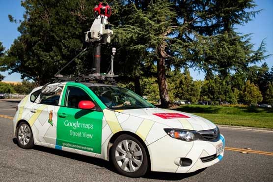
India rejects Google Street View over security concerns
The wait to see street-level and 360-degree views of Indian cities and tourist spots in Google maps just got longer.
“Google Street View”, one of the most exciting features on the Internet, offers a chance for everyone with an Internet connection to become a virtual traveller (“Google Street View denied security nod”, June 10). The home ministry has conveyed to Google that its plans to cover India through the Google Street View is rejected.
India’s Defense Ministry told the Hindu newspaper that it was impossible to monitor the images Google was taking and failing to do so could damage national security.
India’s interior minister said that Google’s proposed photographic journey was being rejected because of concerns that it could compromise the country’s security. Terrorists could locate all the street and maps, as per Pakistani-American David Coleman Headley.
The Home Ministry has vetoed the deployment of Google’s image-gathering technology, citing security risks.
This isn’t the first time Google’s run into issues with Street View.
Last year, Google Street View partnered with environmental monitoring company Aclima, which allowed cars to carry sensors to detect pollutants such as nitrogen dioxide, ozone, and particulate matter.
However, you would be hard-pressed to use Street View in India as you would in any western country.
The search giant uses specialized vehicles with high-resolution cameras to map landmarks and iconic buildings, offering users the ability to view 360-degree imagery from the comfort of their homes.
In 2011, police in the southern city of Bangalore stopped Google from collecting images for its service in the city on an experimental basis after police objections. Since then, several important historic landmarks and UNESCO World Heritage Sites have been included on its website, such as Taj Mahal, the Qutub Minar, Red Fort and Ajanta Caves.
An unnamed Senior Govt. official said, “The main concern was security of sensitive defence installations”. The Centre is already planning to bring in the Geospatial Information Regulation Bill, 2016, whose stringent provisions have led to a controversy. According to the draft bill wrong depiction of India’s map could land the violators in jail with a maximum term of seven years and fine upto Rs 100 crore.


