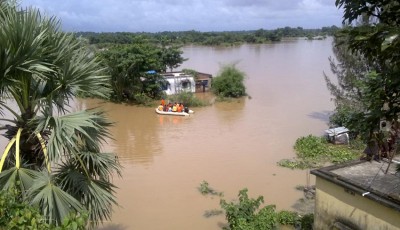
Heavy rains in West Bengal, Odisha as cyclone Komen nears
Some other districts will get more rain.
Gangetic West Bengal, the Northeastern States and Odisha in the east and the plains of northwest India would witness very heavy to heavy rainfall over the next couple of days. On Tuesday, the depression was lying 340 km east of Balasore.
Sahu said another depression centered over Rajasthan will also trigger h…
According to the forecast, heavy to very heavy rainfall will occur at a few places with isolated extremely heavy falls over Gangetic West Bengal Thursday and Friday.
Heavy to very heavy rainfall is also expected at isolated places over north Rajasthan on 30 July. “After landfall, it (Komen) would move initially northwestwards and then west-northwestwards (Gangetic West Benal) and weaken gradually”, said the IMD while predicting that the cyclonic storm is in the process of crossing Bangladesh coast between Hatia and Sandwip.
There would be rains at most places, with heavy to very heavy rainfall at isolated places over the north-eastern states of Mizoram, Tripura and south Assam on July?30 and 31. The cyclone is expected to attain the wind speed reaching 65-75 kmph gusting to 85 kmph.
Danger Signal Number Five (D-V) has been kept hoisted at all ports in Odisha. Medical teams, local hospitals and volunteers are all prepared to attend to emergencies while fishermen, trawlers and boatmen have been advised to stay close to the coast.
A flood in the Baitarani and Subarnarekha river systems is expected and therefore the districts are asked to remain prepared for the eventuality, said water resource department secretary P K Jena.
“Sea condition would be high over north Bay of Bengal during the same period”, said the IMD.


